Then and Now: 10 Times New York City Drastically Changed via Google Maps

Then and Now: 10 Times New York City Drastically Changed via Google Maps

The High Line, Downtown Brooklyn, and Hudson Yards are some of the most dramatic examples of New York City's redevelopment.

We may earn a commission from links on this page.
Start Slideshow
Image for article titled Then and Now: 10 Times New York City Drastically Changed via Google Maps
Image: THONGCHAI.S (Shutterstock)

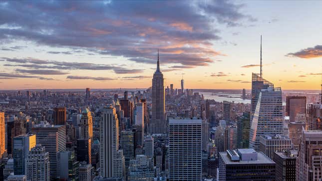
New York City has always been a major hub for financial, commercial, and cultural development with its iconic skyscrapers and dense population. But over the past decade or so, we’ve been able to see the way the city has changed like never before—with Google Maps. Google Maps allows users to (depending on the location) view previous eras of an area using Street View. By entering Street View on Google Maps and clicking “See more dates” in the top left corner, you can see how a particular section of the world has changed assuming it’s been photographed by Google more than once.

New York City is always bustling with development projects, and some of the largest projects and most visited areas of the city have photospheres dating back to 2009. With that, Gizmodo scoured the city for the most abrupt changes in the skyline and went back in time to compare then and now.
Advertisement
Previous Slide
Next Slide

2 / 12

The High Line

The High Line

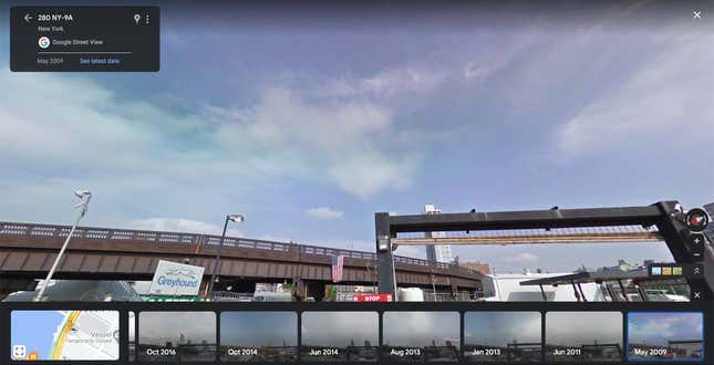
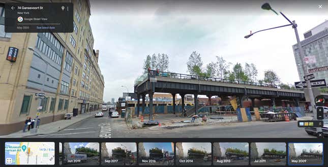
The end of the High Line in May 2009.
Screenshot: Gizmodo

The High Line is a 1.45-mile-long urban park consisting of repurposed elevated railway tracks with construction breaking ground in 2006. In 2019, the final section of the High Line—the Spur—was opened right around Hudson Yards. Here’s the High Line in July 2022.

Image for article titled Then and Now: 10 Times New York City Drastically Changed via Google Maps
Screenshot: Gizmodo
Advertisement
Previous Slide
Next Slide

3 / 12

Billionaires’ Row

Billionaires’ Row

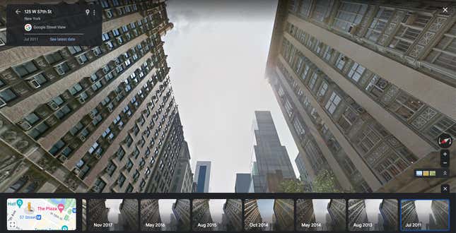
A yet-to-be Billionaire’s Row in July 2011.
Screenshot: Gizmodo

Billionaire’s Row on 57th Street in Manhattan is home to some of Manhattan’s ugliest buildings. The super tall and super skinny buildings are home to the world’s elite, who rarely live in them and, instead, use them as investment opportunities. The skyscrapers on Billionaire’s Row have sprung up in recent years, but here they are in August 2022.

Image for article titled Then and Now: 10 Times New York City Drastically Changed via Google Maps
Screenshot: Gizmodo
Advertisement
Previous Slide
Next Slide

4 / 12

The Bronx

The Bronx

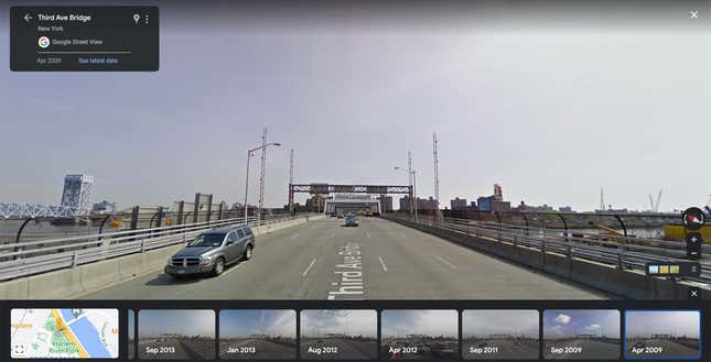
The edge of the Bronx in 2009.
Screenshot: Gizmodo

As Manhattan gets more and more populated, residents of the borough are constantly on the lookout for cheaper housing. Look no further than the Bronx, which is seeing dramatic levels of gentrification as rents in Manhattan spike. Here is an image of the Bronx from the Third Street Bridge in October 2022:

Image for article titled Then and Now: 10 Times New York City Drastically Changed via Google Maps
Screenshot: Gizmodo
Advertisement
Previous Slide
Next Slide

5 / 12

Little Island

Little Island

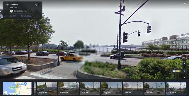
A non-existent Little Island in June 2009.
Screenshot: Gizmodo

Little Island is a recently opened urban green space located in the Hudson River to the west of Manhattan’s Chelsea neighborhood. The park opened in May 2021, and here it is in July 2022:

Image for article titled Then and Now: 10 Times New York City Drastically Changed via Google Maps
Screenshot: Gizmodo
Advertisement
Previous Slide
Next Slide

6 / 12

Downtown Brooklyn

Downtown Brooklyn

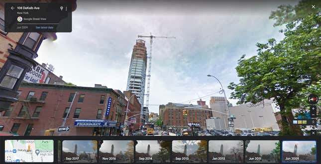
Downtown Brooklyn in 2009.
Screenshot: Gizmodo

Brooklyn has seen spillover from Manhattan for years. As such, the Brooklyn skyline is becoming more and more dramatic and the addition of The Brooklyn Tower at 9 Dekalb Avenue is helping cement Brooklyn as an infamous U.S. skyline. Here is Downtown Brooklyn in July 2022:

Image for article titled Then and Now: 10 Times New York City Drastically Changed via Google Maps
Screenshot: Gizmodo
Advertisement
Previous Slide
Next Slide

7 / 12

The World Trade Center

The World Trade Center

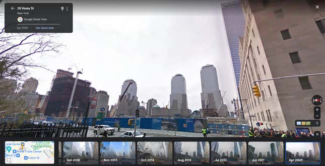
The site of the World Trade Center in April 2009.
Screenshot: Gizmodo

The World Trade Center was decimated in the terrorist attacks on September 11, 2001, but after years of decisions and constructions, the World Trade Center has been resurrected as Freedom Tower and the Oculus, seen here in July 2022:

Image for article titled Then and Now: 10 Times New York City Drastically Changed via Google Maps
Screenshot: Gizmodo
Advertisement
Previous Slide
Next Slide

8 / 12

Coney Island

Coney Island

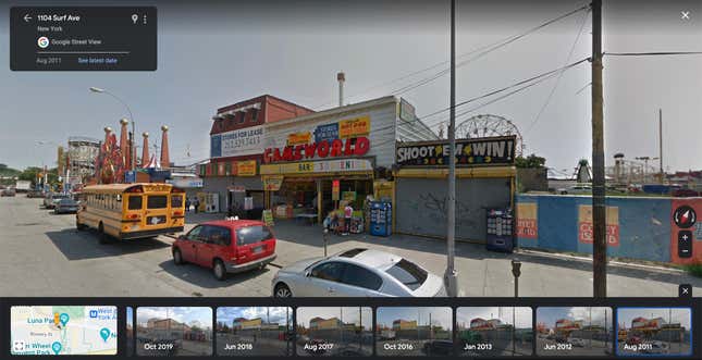
Coney Island in August 2011.
Screenshot: Gizmodo

Fans of Mr. Robot are deeply familiar with Coney Island, the base of the show’s hacker group. With new innovations in amusement technology, Coney Island’s Luna Park has seen new rides installed in the last decade while the historic Coney Island Cyclone still remains. Here is Coney Island in July 2022:

Image for article titled Then and Now: 10 Times New York City Drastically Changed via Google Maps
Screenshot: Gizmodo
Advertisement
Previous Slide
Next Slide

9 / 12

Hudson Yards

Hudson Yards

An empty lot, which would become Hudson Yards, in May 2009.
Screenshot: Gizmodo

Hudson Yards was a massive undertaking by New York City. Phase 1 of construction was mildly interrupted by the pandemic, but the second and final phase of construction—a platform and development above the train yard—is on an indefinite pause. Here it is in August 2022:

Image for article titled Then and Now: 10 Times New York City Drastically Changed via Google Maps
Screenshot: Gizmodo
Advertisement
Previous Slide
Next Slide

10 / 12

The Battery

The Battery

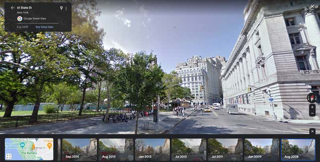
The Battery neighborhood in August 2008.
Screenshot: Gizmodo

The Battery is Manhattan’s southern tip. This area is mostly made up of historic buildings, but since August 2008, there has been some new development just north of The Battery. Here it is in July 2022:

Image for article titled Then and Now: 10 Times New York City Drastically Changed via Google Maps
Screenshot: Gizmodo
Advertisement
Previous Slide
Next Slide

11 / 12

Times Square

Times Square

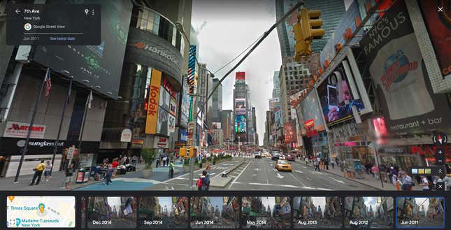
A bustling Times Square in June 2011. Not much has changed.
Screenshot: Gizmodo

Times Square in June 2011 is more of the same, save for some antiquated billboards for Kodak and Ryan Reynold’s Green Lantern. Here it is in August 2022:

Image for article titled Then and Now: 10 Times New York City Drastically Changed via Google Maps
Screenshot: Gizmodo
Advertisement